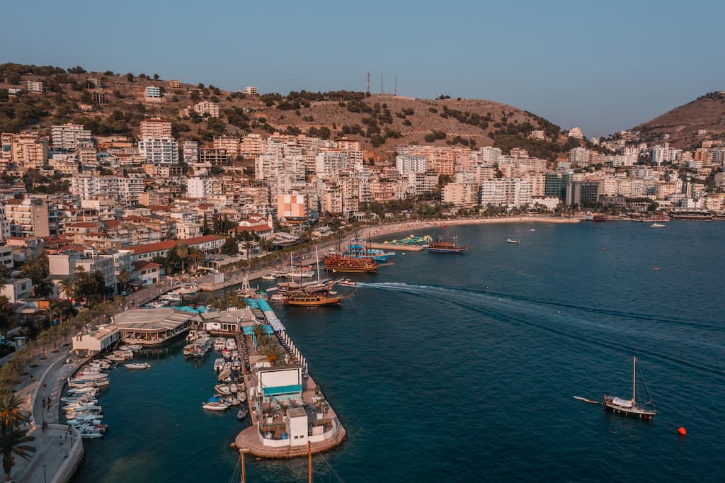
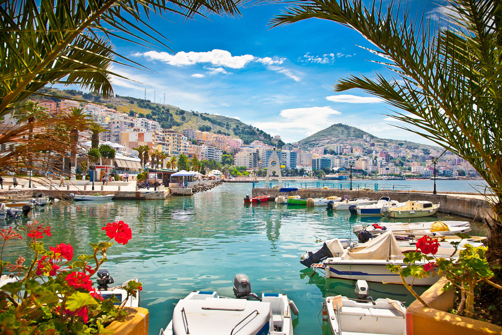
Municipality of Saranda
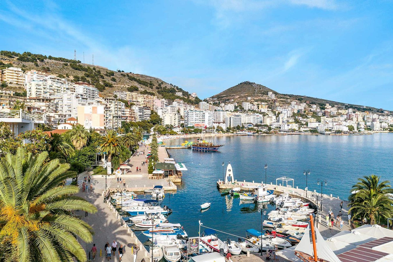
The municipality of Saranda is located in an open coastal bay of the Ionian Sea in Southern Albania and
its coast is one of the most important tourist attractions of the Albanian Riviera.
The territory of Saranda Municipality is 58.96 km2. The municipality was formed with the governance reform
of 2015, uniting the former Municipality of Saranda with the municipality of
Ksamil. Saranda is accessible by road from three directions: the road coming from Gjirokastra
(distance 55 km) which is not in good condition, the coastal road coming from Vlora (distance
124 km) which is very panoramic and in good condition as well as the road from Konispoli with
access to Greece at the Qafë Bote border crossing point (distance 42 km), which is a
new two-lane road in very good condition.
The road linking Saranda to the archaeological site of Butrint, passing through Ksamil village, has recently undergone rehabilitation as a modern two-lane road with high safety and signaling standards. While Saranda boasts a developed road network, the rapid urban growth has led to deterioration in many areas. Plans are in place to construct a new road through the valleys of Kardhiqi (Municipality of Gjirokastër) and Kalases (Municipality Delvinë), aiming to shorten travel distances, reduce travel times, and adhere to road standards.
Saranda is accessible via ferry services to and from the port of Corfu, Greece, with two regular lines offering passenger and car transport, plus an additional seasonal service. A newly constructed passenger terminal at Saranda port accommodates ferry operations. Cruise ships also visit Saranda, though the current terminal lacks docking space for larger vessels.
Saranda maintains intercity transport links with several urban centers: eight daily connections to Tirana via the Gjirokastra route, and four times daily (every two days) via the coastal route. There are daily services to Berat and Elbasan, twice daily to Gjirokastër, four times weekly to Përmet, and thrice weekly to Korça.
Saranda offers convenient urban transport links to neighboring Delvina every 15 minutes, along with two bus routes connecting Saranda to Qafe Bote and Butrint. Private taxi services are also available. The climate of Saranda Municipality is Mediterranean, characterized by mild winters and hot, dry summers. The average annual temperature is 17.1°C, with January being the coldest month at 9.7°C and August the hottest at 25.1°C. Annual rainfall averages 1,500 mm, peaking in October, November, and December. The region enjoys 270-300 sunny days annually, with sea temperatures ranging from 17-22°C from May to mid-October.
Historically, Saranda traces its origins to the 6th-century Monastery of 40 Saints ("Santi Quaranta"), located atop a hill overlooking the city. It served as an important port of Epirus known as Onchesmos. Saranda is renowned for its natural beauty and archaeological treasures, most notably the UNESCO World Heritage site of Butrint, located south of the city.
Apart from its beach tourism appeal, Saranda Municipality boasts significant potential for outdoor tourism activities. According to INSTAT economic statistics, the GDP for Vlora District in 2015 was 580.4 million euros, with a per capita GDP of 3,084 euros, slightly lower than the national average of 3,547 euros. As of 2017, Saranda Municipality registered 2,355 businesses, predominantly in services (trade, transport, accommodation, food services, information, communication, and other services), which constituted 84.4% of total businesses. Accommodation and food services alone accounted for 26% of these businesses. Agricultural activities, including olive and citrus fruit cultivation, as well as increasing viticulture, represent 6.6% of registered businesses, while 9% are engaged in industry and construction.
Based on Saranda Municipality economic statistics, the total revenue for 2016 reached 220 million euros, marking a 7.3% increase from 2015. Per capita income stood at 4,040 euros annually.
In 2016, Saranda Municipality had a working-age population of 37,150, with an unemployment rate of 10.5%. According to the Territorial Development Plan, as of 2014, the highest employment levels within Saranda administrative unit reached 54.9%, while Ksamil administrative unit reported 49.3% employment. Both areas showed predominant employment in the services sector, with rates of 68.5% in Saranda and 62.9% in Ksamil. Industry followed as the second most significant sector for employment, while agriculture had the lowest employment rates.
During the period from 2005 to 2015, the construction sector experienced considerable growth. In 2014, approximately 30% of rural Saranda's workforce was employed in agriculture, with equal distribution in tourism, services, trade, and construction. Ksamil administrative unit's economic activity centers primarily on tourism, supported by construction, fishing, and fruit cultivation, particularly mussel farming in Lake Butrint.
Saranda faces significant migration challenges, largely influenced by its proximity to Greece. According to the Territorial Development Plan, 20-25% of local families have emigrated abroad or relocated within Albania. Additionally, there is noticeable migration into Ksamil administrative unit from other parts of Albania, alongside return migration of emigrants to their hometowns.
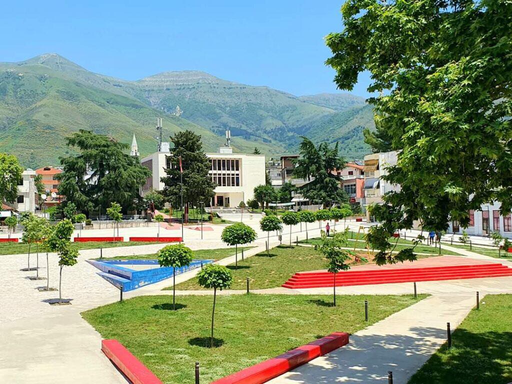
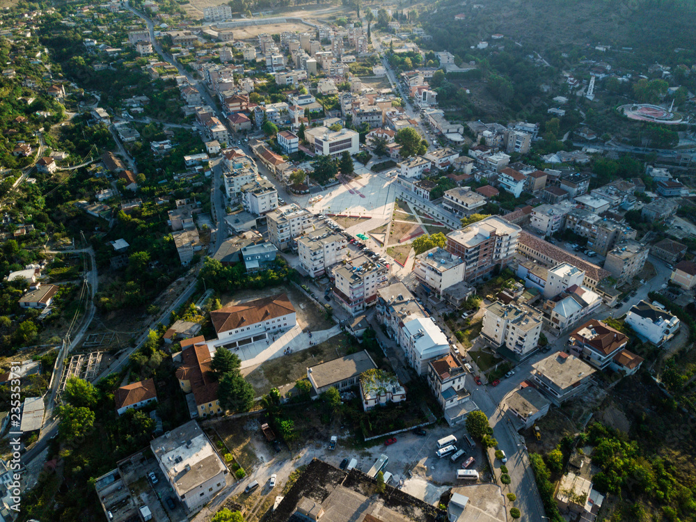
Delvina
Delvina, the former capital of the Ottoman sanjak in southern Albania, once held significant administrative and military importance, though no historical monuments from that era remain preserved today. This context serves to illustrate the caution required when evaluating the cultural heritage of the Ottoman civilization in any region based solely on the existing preserved monuments.
According to Evlia, several Islamic buildings were noted in Delvina, including the mosques of Bayazid in Vlaqa village and Gjin Aleksi village. Delvina historically housed three madrasas, three mejtepe, a hammam, three teqes, and three inns. The residents predominantly spoke Albanian and had little understanding of Greek. Under the rule of Ali Pasha Tepelena, there is speculation that he may have reconstructed the ancient castle. According to the Ottoman salname of the vilayet of Ioannina from 1306 H (1888/89), Delvina had a population of 2,200 inhabitants, and records list nine mosques, including those named after Bayazid Veli, Sijavush Pasha, Haxhi Ali, Hajdar Babai, Mustafa Pasha, Avanoz Bey, Haxhi Ali Efendi, Ali Pasha, and Ahmed Bey.
During World War I, Ottoman Delvina was devastated by the Greek gangs of Zagrofos. Between the world wars, Delvina underwent a reconstruction along a charming and bustling route. Unfortunately, much of the old castle and many mosques were left in ruins. When Babinger visited the country in the 1920s, he found only one mosque remaining—the Haxhi Ahmed Agai Mosque, dating back to 1872. At that time, Delvina boasted a population of 3,000 inhabitants, with a majority being Muslims.
After World War II, Delvina was completely rebuilt in a modern style. Sadly, the last mosque was destroyed during the Cultural Revolution of 1967. Today, only a few remnants remain of the castle originally rebuilt by Ali Pasha in the early 19th century.
Saranda Municipality offers not only stunning beach vacations but also abundant opportunities for outdoor tourism activities. According to economic statistics published by INSTAT, the GDP in current prices for Vlora District in 2015 totaled 580.4 million euros, with a GDP per capita estimated at 3,084 euros, slightly below the national average of 3,547 euros. In 2017, Saranda Municipality boasted 2,355 registered businesses, predominantly in service sectors such as trade, transport, storage, accommodation, food service, and information technology, accounting for 84.4% of all businesses. Agriculture, forestry, fishing, industry, and construction sectors collectively represented 15.6% of registered businesses. The region is renowned for its production of olives, citrus fruits, and an emerging viticulture sector. Economic data from Saranda Municipality indicates that annual revenue in 2016 reached 220 million euros, reflecting a 7.3% increase from 2015, with an income per inhabitant averaging 4,040 euros.
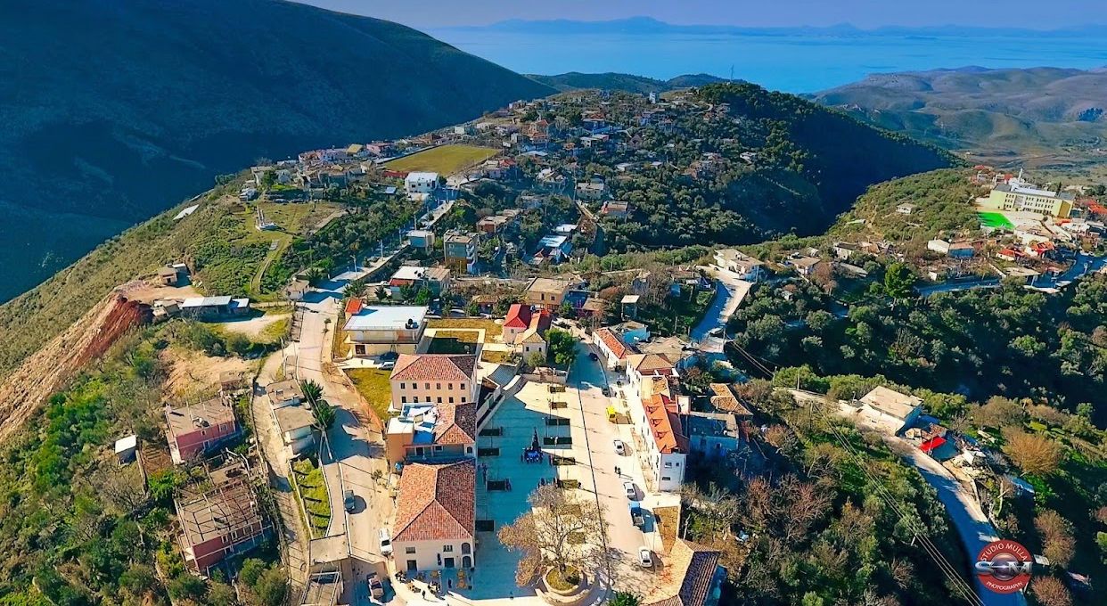
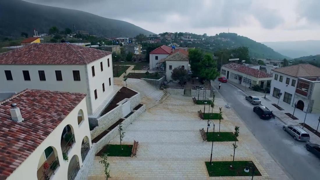
Finiqi
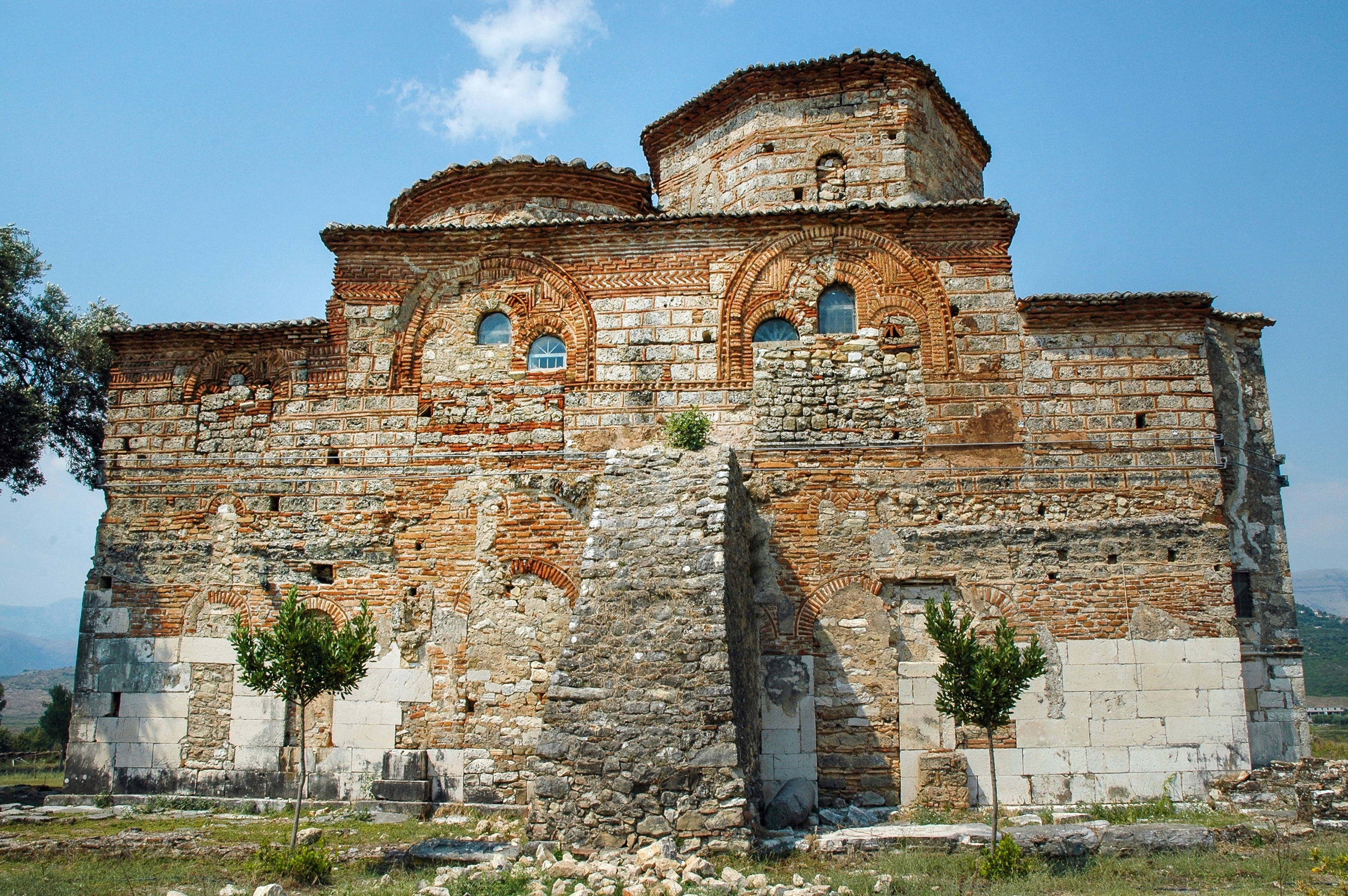
Finiqi, known for its ancient city of Foinike, stands atop Finic Hill (282 m), east of the village bearing the same name. Positioned at the confluence of the Bistrica and Kalasa rivers in Albania, Finiqi historically controlled crucial natural routes originating from the Gorges of Antigone and Kaonia. These routes passed through the Skërfica and Muzina passes. The city, approximately 7 km from the shoreline, likely utilized the port of Onkezm for maritime activities in antiquity.
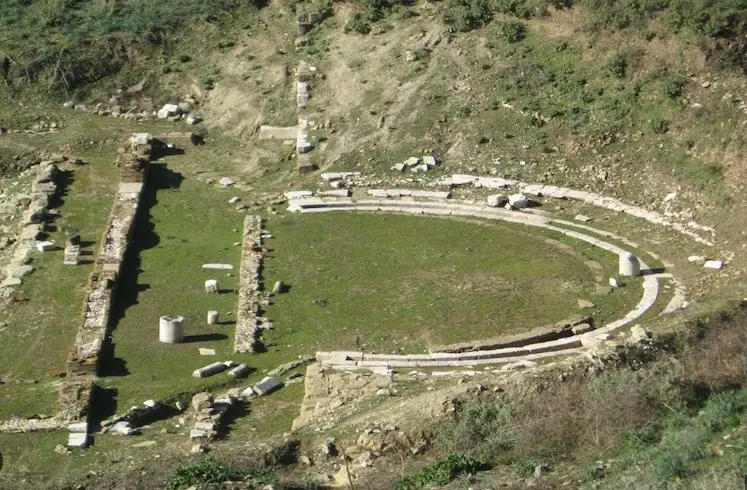
Phoenician architecture in Finiqi reflects typical Epirote styles, akin to those found in South Illyria. The city's fortifications resemble those of Gurëzeza in the Byline area and share construction techniques with Butrint, Chuka of Ajtoj, Borshi, and Himara. Notably, octagonal columns indicate ties to the Byline region and Apollonia. Sculpture from the Hellenistic period, often crafted from local soft limestone sourced from Akrokeraunet, includes artifacts like a statue of Artemis and a small torso of a boy measuring just 37 cm. Additionally, Dh. Budina's publications feature three marble heads dating to the 3rd century BC.
During the Antonine period, several high-quality marble sculptures were produced. Notably, an acephalous statue of Artemis (0.85 m tall) was discovered in apartment C 11 during excavations. Another significant find is the head of a boy, crafted from local limestone, which dates to the Severus period. This promotional narrative, available in both Albanian and English, will be featured on VSA's social media channels and website. Early pottery unearthed from the necropolis dates back to the latter half of the 4th century BC, though its precise origins remain uncertain. Local pottery production commenced in the 3rd century BC, featuring styles typical of the Hellenistic period and later, Roman influences.
Konispoli
Konispoli is situated at the southernmost tip of Albania, just a few meters away from Greece. The town is located on a plateau divided into four rounded hills with a deep stream. At its foothills lies a unique valley, renowned throughout the Balkans and beyond for its enviable ecosystem and habitat. In ancient times, this area was home to one of the most magnificent cities, featuring castles and typical walls similar to those found in Butrint. Konispoli is often referred to as the twin city of the renowned Butrint, highlighting its historical significance.
History:
Konispol has been inhabited continuously since the Middle Paleolithic period, with a rich civic life spanning all historical eras. Archaeological excavations conducted 3 km west of the city, along the Sterra shore, have unearthed 20 ruins of dwellings, a water well, and pitos (storage vessels) dating back to the 3rd century BC. In the hills of Narta, remnants of an 11th-century BC castle have been discovered, containing the remains of four dwellings. Further west, in Lumbardha, seven preserved dwellings and several tombs from the 12th century have been found.
The first written mention of Konispol appears in the 8th century. Following the Turkish invasion, many Albanians from the Konispol region migrated and settled in the village of Hore of Arbëresh in Sicily. During Ottoman rule, Konispol took on the characteristics of an oriental urban settlement.
In the 15th century, the cobbled bazaar was constructed, alongside workshops, two-story houses, cafes, restaurants, and taverns. Throughout the 19th century, the city experienced significant urban, artisanal, and commercial development. By the early 20th century, the city boasted 400 houses. The city's name derives from a Slavic toponym, "konj" meaning "horse," and "polie" meaning "field" (field of horses). Similar toponyms can be found throughout Albania, originating from the 14th century when the Serbian Empire under Tsar Stefan Dušan conquered and colonized many territories in Western Balkans, including Albanian lands. Konispoli emerged as a civic center and underwent substantial growth and development after the 1950s. During this period, multi-story buildings and social-cultural institutions were erected, and main streets were paved and illuminated, enhancing the residential urban landscape.
Konispoli boasts a rich civic heritage and is celebrated for its patriotic, educational, and cultural traditions. The residents of this area have long been champions of education, culture, and the Albanian language, spearheading efforts to establish schools in the villages and beyond. From the early 17th century until 1910, Konispoli housed a Madrasah with a four-year curriculum, attended by approximately 70 boys from towns and villages across Chameria. In 1910, the first Albanian national club and school were inaugurated, briefly closing in 1911 before reopening in 1916. Progressive elements established the "Chame Brotherhood" society in 1921, further enhancing cultural and educational endeavors in Konispoli. The city is also home to notable historical figures such as Osman Alush Taka, Mahmut Dalani, Muharrem Rushiti, and many others, as well as literary figures like Muhamet Kuçuku, Ibrahim Hoxha, Pajtim Çaushi, Veiz Sejko, and numerous others.
Konispoli is synonymous with Cham culture and traditions. The traditional attire of men and women in the 18th and 19th centuries featured intricate designs crafted by skilled artisans from Ioannina. Renowned for its beauty, the folk costume of Konispoli is considered among the most exquisite in Europe. The men's folk dress from Konispoli gained significant attention at the 1973 National Folk Festival, notably worn by dancer Taip Medani during the performance of the renowned "Osman Taka" dance. Similarly, the distinctive dances of the women from this region are celebrated. Today, these traditions are upheld by the "Artistic Group of Konispoli," which showcases them in cultural events both domestically and internationally.
Onhezmi
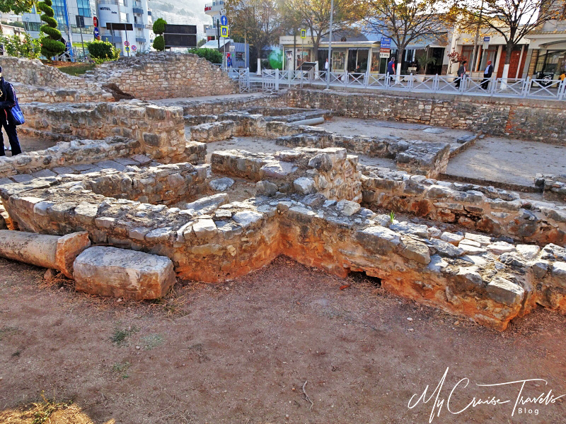
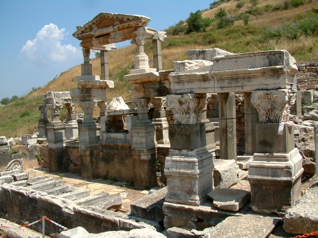
Onhezmi first appears in ancient written sources around the 1st century BC, mentioned by Strabo and Dionysius of Halicarnassus, and later by Ptolemy two centuries later, who referred to it as a Chaon Cove. Based on their accounts, scholars and travelers such as Pukevili, Liku, Isamberti, and others have debated since the last century whether Onhezmi corresponds to the visible ruins found in present-day Saranda, situated along the scenic Ionian coast of Southern Albania.
Recent archaeological excavations have revealed the developmental dynamics of Onhezmi across three distinct phases. The first phase spans from the 4th to 1st century BC, characterized by the discovery of Ionic columns, capitals, and ancient coins. During this period, Onhezmi likely functioned as a significant port of Phoenice, one of the foremost cities in Epirus.
In the 1st century AD, marking the beginning of the second phase, Onhezmi expanded its influence following the Roman conquest of Illyria and Epirus. This era saw the resurgence of Onhezmi as a pivotal port facilitating connections with Rome and other provinces, notably Phoenice and its environs.
Archaeological findings, including a multitude of amphorae discovered in the bay of Saranda, further corroborate the existence of a pier during the 1st to 3rd centuries AD. These amphorae exhibit diverse shapes and typologies characteristic of the Southern Adriatic and Ionian regions.
Among the notable discoveries from this era, attention is drawn to the remnants of buildings, particularly alcoves situated along the shoreline. Constructed using techniques such as "opus incertum," "opus mixtum," and incorporating six-course brick layers, these structures feature walls intricately combining stones in "opus reticulatum" and "opus quadratum" styles. These methods were predominantly employed in monumental constructions during the 1st to 3rd centuries AD.
The interiors of these buildings are adorned with mosaic floors, showcasing elaborate geometric motifs including circles, squares, rhombuses, triangles, spirals, and meanders. These designs, harmoniously interwoven, are reminiscent of motifs found in other ancient sites across Albania, such as Butrint, Apollonia, and Dyrrachium, dating back to the 2nd and 3rd centuries AD.
During this phase, Onhezmi expanded significantly from the "Butrint" hotel in the east to the present-day port in the west. These coastal structures, many featuring mosaic-floored interiors, likely served as residences or villas for affluent classes of the time.
The presence of these honors, the necropolis, and a diverse array of archaeological artifacts including amphorae and coins recovered from the sea, alongside references by Dionysus of Halicarnassus to a "shrine honoring Aphrodite," indicate that Onhezmi had transformed into a permanent settlement by this time. It maintained relations with its hinterland and with Rome, likely serving as a pier for Phoenicia and its neighboring regions. This was facilitated by its strategically advantageous geographical position and protected bay, allowing year-round use of the pier.
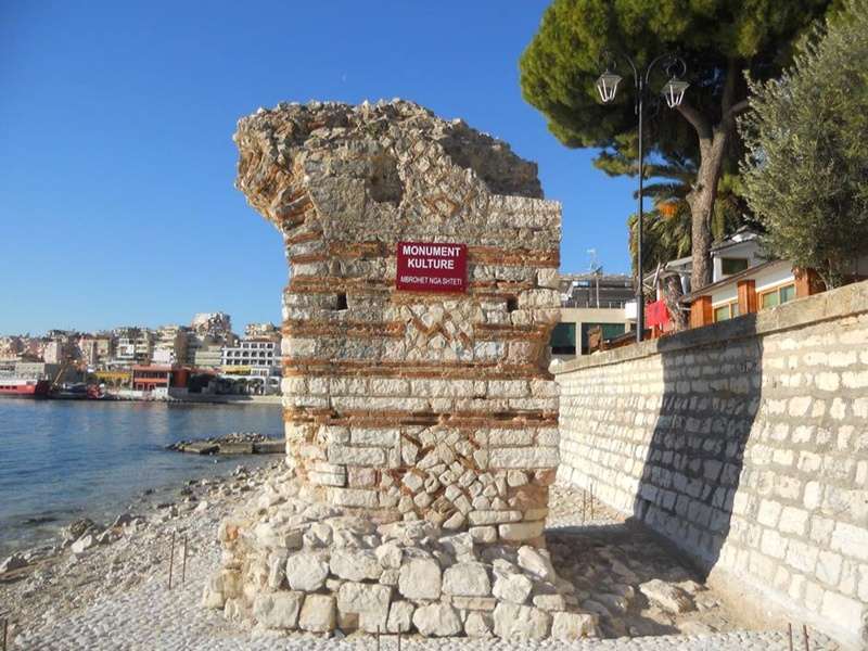
By the 4th century AD, coinciding with the onset of its third phase, Onhezmi began fortifying itself in response to the upheavals of the slave-owner order and the changing political landscape. This defensive strategy, observed in many cities across the Illyrian and Epirote provinces, involved the construction of a robust surrounding wall. Excavations within the castle walls have provided insights into its architectural layout. Notable discoveries include two dwellings on the western side and one on the eastern side, each featuring two or three quadrangular alcoves. One of these dwellings housed one or two cisterns, whose inner surfaces were originally plastered with lime and fine sand. Additionally, traces of brick dust were found on the floors, suggesting their intricate construction.
A significant discovery in Onhezmi is the large basilica located in the eastern part of the castle. This three-storey structure features arcades supported by pilasters and includes several ancillary rooms. Notably, the architectural highlight is its vibrant mosaic flooring. Another intriguing aspect is the discovery of a second mosaic floor beneath the upper floor, partially uncovered.
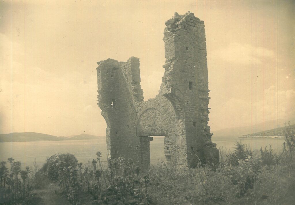
A notable development observed in the 6th century AD is Onhezmi's mention in various ecclesiastical documents as the episcopal center named Anchiasmos. This period also witnessed the transformation of pagan monuments into Christian ones, evident in the reconstructions of the basilica on the eastern side of the castle. Additionally, the construction of the grand basilica of the "40 Saints" atop the hill to the east of the city highlights its monumental size and planimetric shape, suggesting its role as a significant ecclesiastical center.

.jpg)


.jpg)
.jpg)


.jpg)
.jpg)